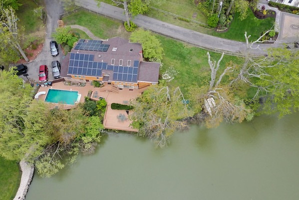
We plan drone imagery around the project objective rather than flying simply to add an aerial shot.Some locations make more sense from above. Aerial photography can reveal property layout, surrounding context, construction progress, access, venue scale, and relationships between spaces that are difficult to communicate from ground level.
A useful drone image begins with the question the aerial view needs to answer. A real estate property may require context. A construction project may need progress views. A commercial campaign may need a dramatic establishing sequence.
Flight planning also depends on airspace, weather, location access, people on site, and applicable FAA requirements.
We identify the address, project objective, required views, timing, and site access.
Airspace, restrictions, weather, permissions, and operational feasibility are reviewed.
Still photographs or video sequences are created around the approved flight plan.
Selected aerial images and clips are refined for the agreed project use.
No. Airspace, restrictions, weather, safety, and property conditions can limit operations.
Yes. A project can require stills, motion footage, or both.
Yes. Aerial views can show the property and its surrounding context.
Yes. Repeatable aerial viewpoints can support progress documentation.
Only when the operation complies with applicable FAA airspace requirements.
Yes. Wind, precipitation, visibility, and other conditions may affect safe flight.
Send the address, required views, intended use, and preferred timing so flight feasibility can be reviewed.